
Park Slope Neighbors Meet To Map Out Dangerous Roads And Intersections


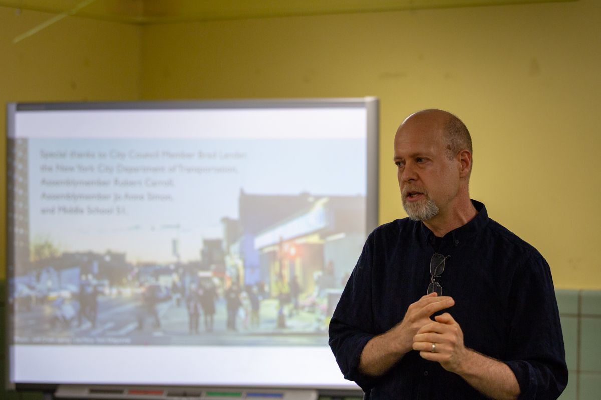
PARK SLOPE – The cafeteria of MS 51 was packed Wednesday evening with concerned locals eager to voice their concerns about dangerous Park Slope streets to Council Member Brad Lander and the New York City Department of Transportation (DOT).

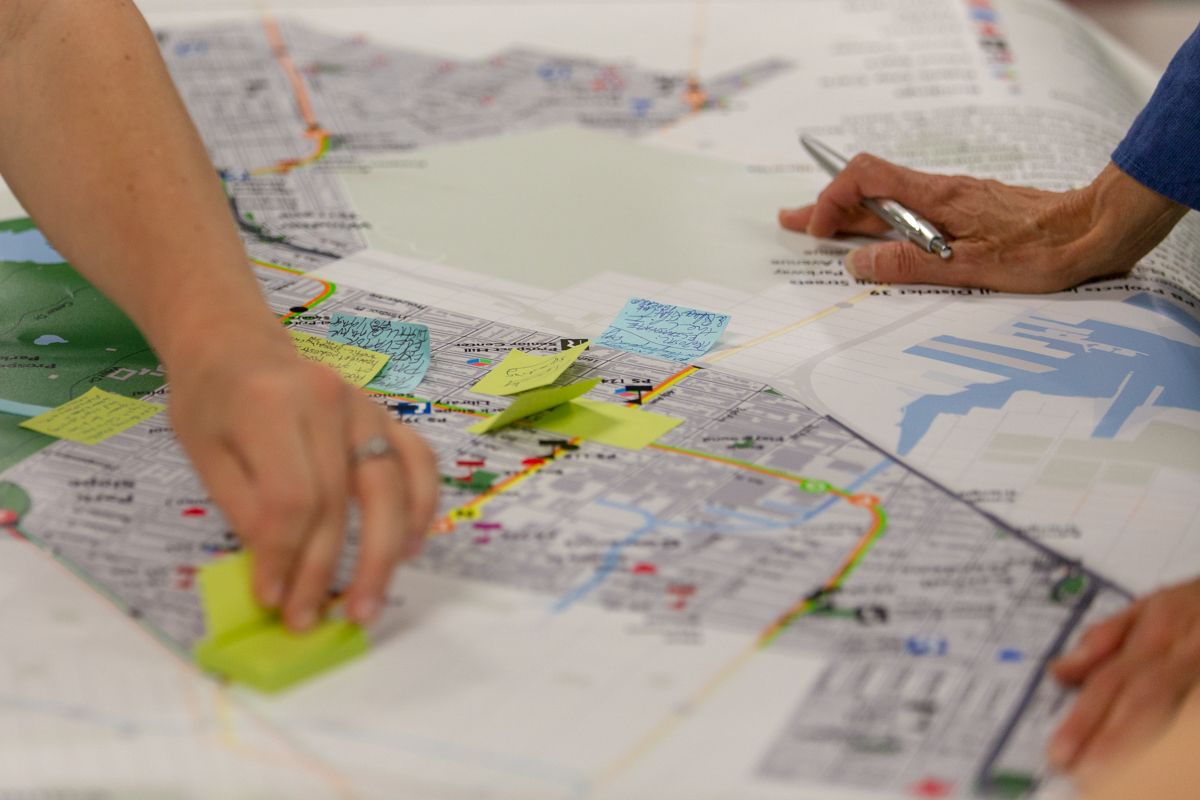
Organized by the Park Slope Street Safety Partnership, the town hall-style workshop aimed to identify dangerous locations across the neighborhood, and other areas in Community Board 6, and work with DOT in implementing solutions.
“The goal is to let people from the neighborhood weigh in on the places in Park Slope that they consider dangerous,” Eric McClure, Chair of the Partnership and co-Chair of the CB6 Transportation Committee, told BKLYNER. “We want to gather that information and pass it on to the Department of Transportation so they can take a look at those locations in Park Slope and figure out what in their tool kit would help address those safety situations.”
“You’re all experts on your own streets or on the corners you have to cross every day in the neighborhood,” McClure said prior to attendees breaking up into groups to discuss problem areas with DOT facilitators. “You know where drivers are speeding regularly, where somebody’s failing to yield, where there are faded crosswalks that need to be repainted, where you might like to ride a bicycle but don’t feel safe doing so because there isn’t a bike lane or the bike lane is insufficient. We’re really looking for your input tonight.”
“The impetus for tonight’s workshop is the terrible crash that happened in early March at the corner of 5th Avenue and 9th Street in Park Slope,” McClure continued. “That was a situation where the driver should not have been on the road. It’s a place where design might not have made any difference because of the circumstances of the crash, but design can make a difference in preventing other crashes in other places and that’s what tonight’s about.”
He then read the names of six children who lost their lives in traffic-related incidents before requesting a brief moment of silence to remember the young victims.
- Abigail Bluemenstein, Joshua Lew, and Sophia Blumenstein killed at 9th Street at 5th Avenue on March 5, 2018 (Sophia was the name of the child Abigail’s mother, Ruthie Ann Miles, was seven months pregnant with at the time of the crash)
- Eleven-year-old Victor Flores and Juan Estrada (ten), killed at 9th Street & 3rd Avenue, Gowanus in 2004
- Four-year-old James Rice, killed at 3rd Avenue and Baltic Street in 2007
- Twelve-year-old Sammy Cohen-Eckstein, killed at 9th Street and Prospect Park West in 2013
- Fourteen-year-old Mohammad Naiem Uddin killed at East Seventh Street at Caton Avenue, Kensington in 2014
- Twelve-year-old Joie Sellers killed at Flatlands Avenue at East 46th Street, Flatlands in 2016
- Seven-year-old Shevon Bethea, killed by an MTA bus on Webster Avenue, the Bronx on May 26, 2018
Bethea’s death marked the sixth child, 14 years of age or under, killed on the streets of New York City this year, McClure noted. “That’s more than in both 2017 and 2016,” he added.
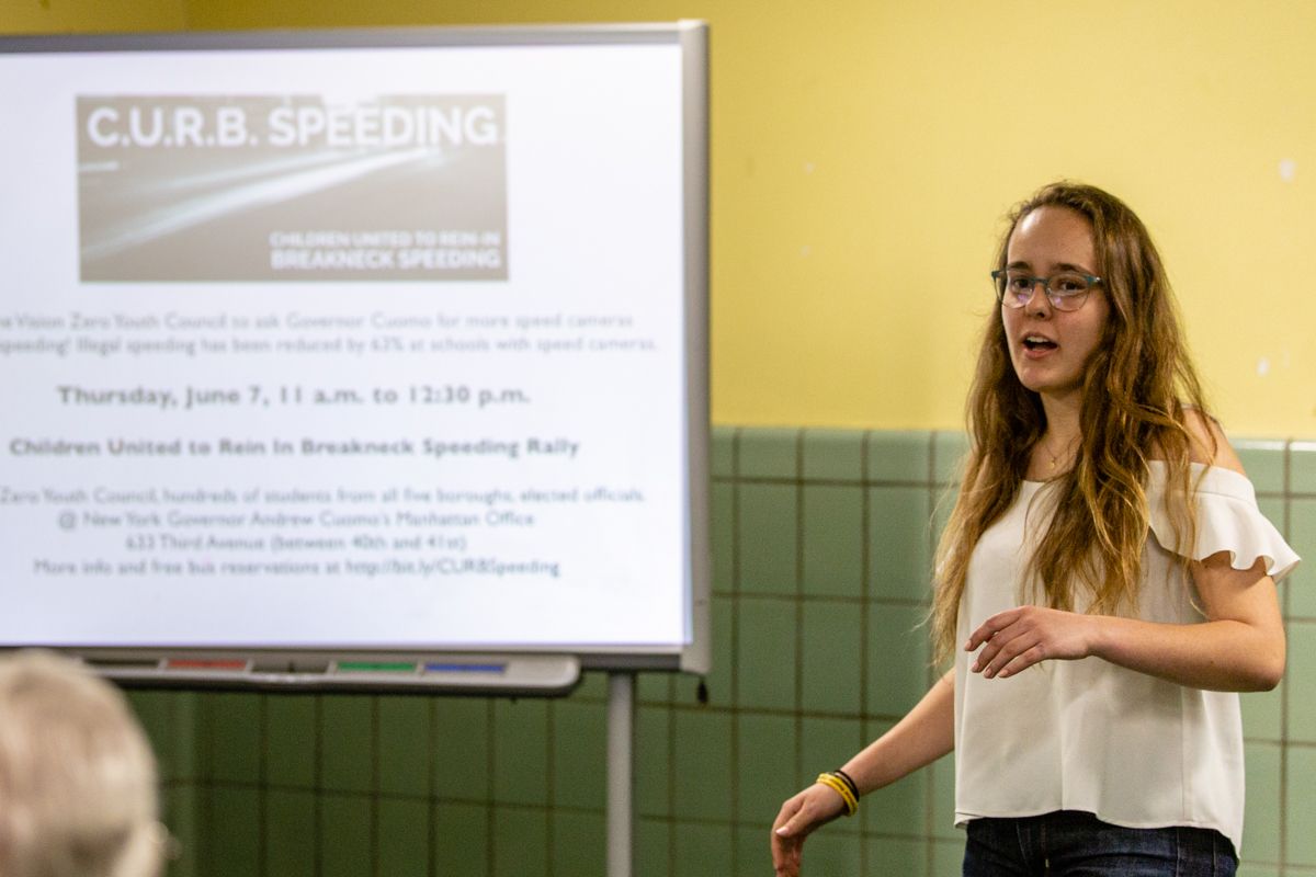
Eckstein, Sellers, and Uddin were all students of MS 51, prompting their classmate Alison Collard de Beaufort to found the Vision Zero Youth Council. De Beaufort informed the audience that the Council is organizing Rally to CURB Speeding next Thursday, June 7, to call on Governor Cuomo to extend and expand the School Zone Speed Camera Program. Mayor de Blasio voiced his support for the speed camera bill at a press conference earlier on Wednesday where he also unveiled DOT’s proposed redesign of 9th Street.
“This is something that we strive for at DOT, to make our city safe for pedestrians, motorists, bicyclists, seniors, and most importantly our children,” said DOT’s Leroy Branch. “That’s what Vision Zero is all about, the goal of Vision Zero is that we have zero deaths.”
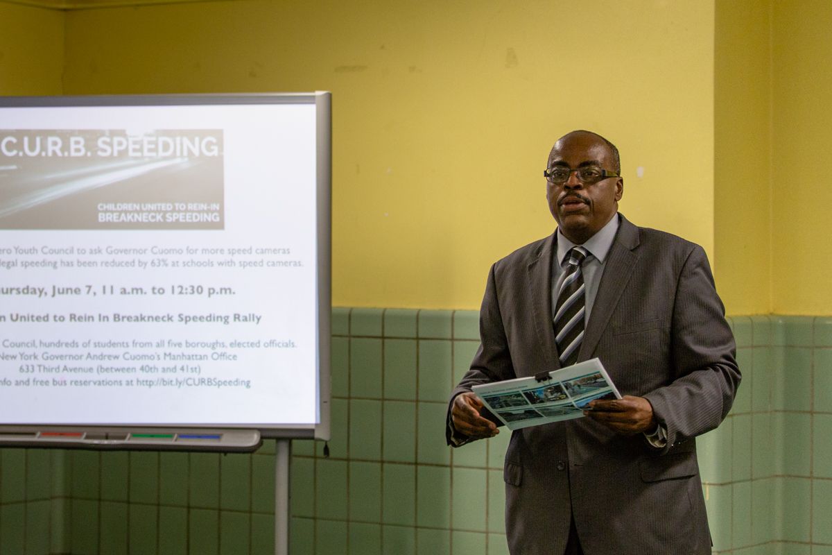
“You don’t have to wait until we have a workshop in order to let us know what’s going on out there,” Branch advised. “You can be our eyes and ears each and every day. If you see a dangerous intersection you can call 311 or you can go to our website and write to Commissioner Keith Bray about any intersection or any unsafe street that you see and we will study it and see what we can do to make that intersection safer.”
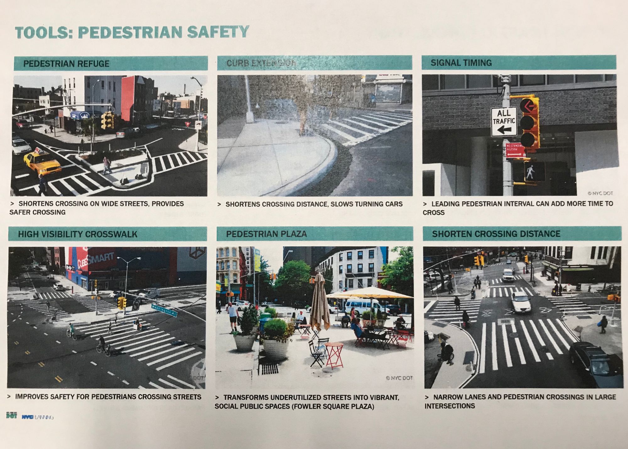
Ted Wright, the Director of DOT’s Bike Program then presented the agency’s proposed redesign for 9th Street. “At this point, this is a preliminary plan, we’re still working on it,” he explained. “We will be presenting it to the Community Board on June 21 [at the CB6 Transportation/Public Safety Committee meeting].”
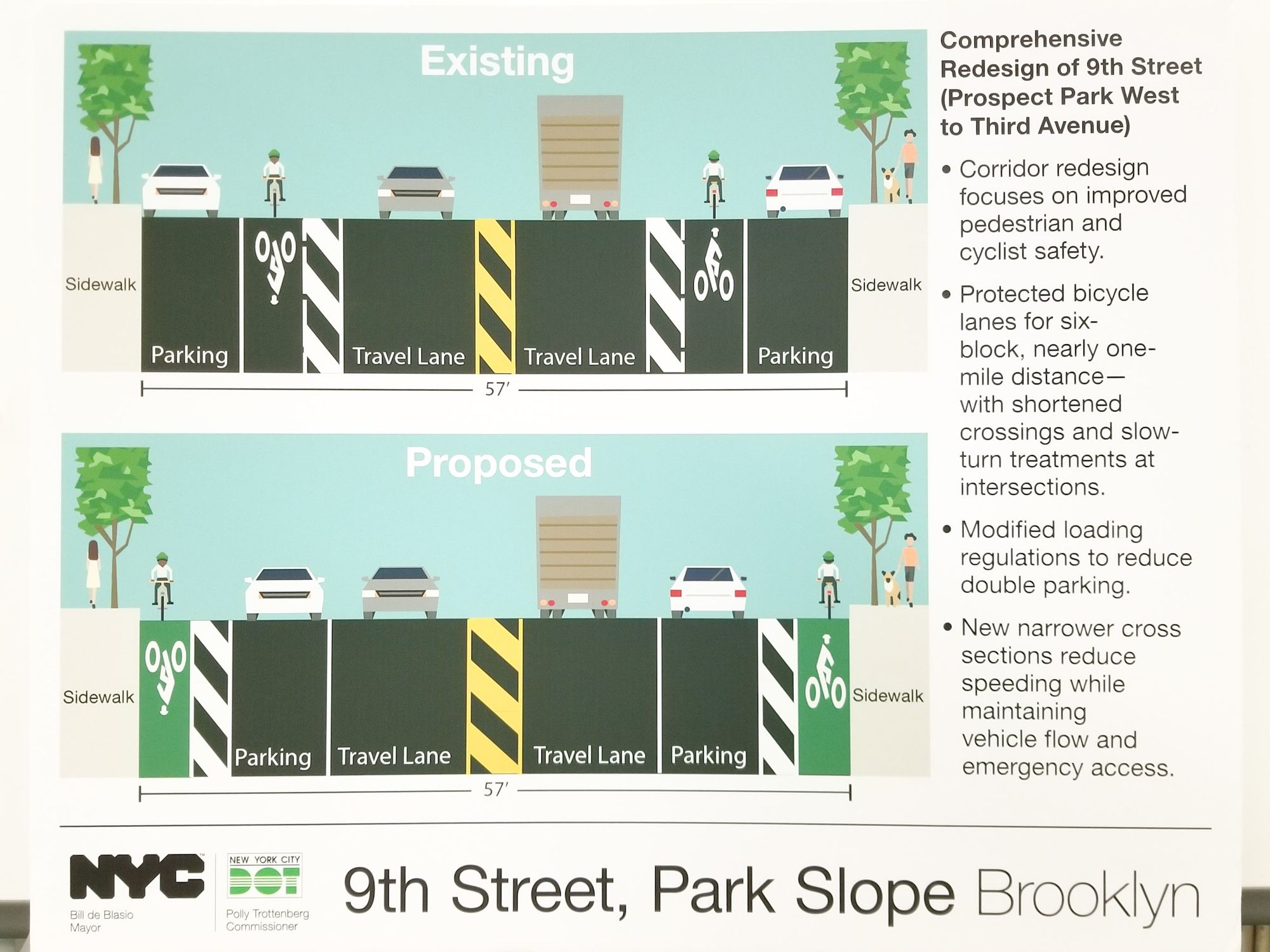
The current layout of the fifty-seven-foot wide corridor (between 3rd Avenue and Prospect Park West) consists of “very large buffered bike lanes and two travel lanes with turn lanes,” Wright said. The proposed plan would shorten the area in the middle of the road and “flip” the bike lanes with the parking lanes.
“One of the greatest things with Vision Zero that we’ve done with bike lanes is narrow the roadway,” he explained. “By narrowing the roadway you reduce free space on the road so people don’t feel like they can move around everywhere. You see very dramatic reductions in speeding.”
Wright noted that DOT will work with CB6 to determine how to deal with conflicts at the intersections. He also assured motorists that the proposal “isn’t all about bike lanes” and insisted that the plan will work with vehicles as well. A narrower roadway “calms drivers [and] changes the scale of the roadway,” and as “vehicle lanes get smaller, [drivers] perceive the road differently,” Wright added. “It’s a positive and we’ve seen very good results.”
Long-time 9th Street resident and Community Board 6 member, Robert Levine, expressed his frustration that the redesign does not include plans to curb truck traffic on the corridor. “There’s not one truck mentioned,” he exclaimed. “And every truck coming from BK8, BK9, Sanitation, comes down 9th Street. Get the trucks off of 9th Street!”
“That’s exactly the stuff that we want to hear from groups. We want to hear that specifically from those businesses on those streets that need truck deliveries,” Wright insisted. “We need to hear these things. That’s why we’re here today. This is not a done deal.”
“We’re here to talk about what the reality is today on 9th Street,” another frustrated neighbor added. “We have trucks coming up 9th Street all day, which is not a truck route. We have DOT trucks coming up 9th Street all day which do not service the neighborhood. We’ve got double-parked trucks doing deliveries to businesses. I’m all in favor of what you’re doing to 9th Street, I think it’s a great idea, but it’s all for naught if we don’t address what’s going on currently which is a ridiculous amount of truck traffic that doesn’t belong on 9th Street because it doesn’t service the neighborhood,” he said.
“And for businesses that need deliveries, what do we do about that once we shrink the street?” he asked.
“The trucks that come down 9th come from District 8 and District 9—central Brooklyn,” Levine told BKLYNER. “They’re supposed to take truck routes. If you look at a map of truck routes, 4th Avenue is a truck route, 3rd Avenue is a truck route. If you come down Atlantic, you can’t make a turn onto 4th Avenue. You can’t make a turn onto 3rd Avenue. The two main truck routes you can’t get on from Atlantic, so how do [the trucks] get anywhere? They have to go through the neighborhoods,” he explained.
Levine believes police enforcement, fining truck drivers for taking non-truck routes, would help reduce the problem.
The issues raised last night were not only centered in Park Slope. “We have our own issues in Kensington—mainly the intersection of Church Avenue and Ocean Parkway,” Mike, a resident of Kensington, said at the start of the meeting.
He also said as a driver, he is concerned that the Prospect Expressway exit ramp at 4th Avenue is now overburdened and is frequently backed up with cars ever since DOT installed an LPI, a Leading Pedestrian Interval light, on 4th Avenue.
“We realized in my office a challenge that we have is that when we start the process of working on an intersection or a street, it’s a little hard if six people have asked us about it, [to] make sure we keep all of you in the loop about it, and DOT gets asked about thousands and thousands of intersections,” said Council Member Brad Lander, whose office collected all the feedback from the meeting and will submit to DOT.
“So we are committing to put online—it’s probably going to take us till this summer because we have to do this for the whole district, not just Park Slope—something to make sure that we are really looking at every intersection and street that people are talking about,” he added. “That we are putting up the crash and injury data there as well and keeping you guys updated on what we’re doing. So everything you’re saying here is not going into a blackhole.”
“I can’t promise that each intersection or street that is being talked about is going to get a treatment,” Lander said, “but I can at least promise we’re going to put it all up online so everybody can see it.”


