
The Most Dangerous Spots in Brooklyn for Cyclists and Pedestrians


After analyzing data across the five boroughs, Localize discovered the areas in which cyclists and pedestrians are at three times greater risk of being injured are killed in a crash—and three of them are in Brooklyn.
Which are the most dangerous neighborhoods? Williamsburg, Downtown and an area of Crown Heights/Bed-Stuy, according to the study.
Analyzing raw data, then accounting for the sizes of intersections, surrounding populations, building density and a number of other factors, Localize found “clusters” where the risk of injury or death was the highest.
For the Localize project, the company collected data from January 1, 2013 until January 1, 2018. Here’s what they found:
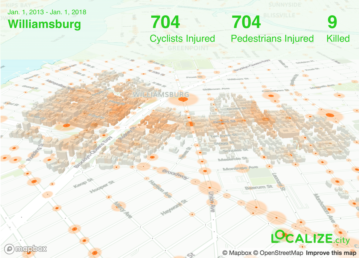
Williamsburg
Cyclists injured: 704
Pedestrians injured: 704
Killed: 9
Cyclists injured: 256
Pedestrians injured: 492
Killed: 6
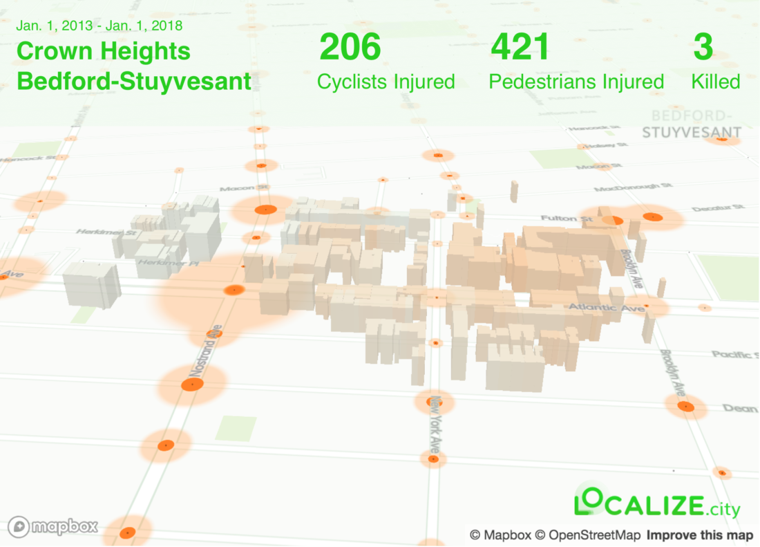
Cyclists injured: 206
Pedestrians injured: 421
Killed: 3
By localizing the crashes based on addresses, the team was able to narrow down the data further than the general data. “This may give you a truer sense of how safe it is to cross a given street than just using raw numbers alone,” said Andrew Lassiter, an urban planner with Localize.
One of the key discoveries was that areas near elevated tracks or bridges and their approaches are far and away the most dangerous spots for cyclists and pedestrians.
“Around major bridges in New York City, you have heavy vehicle, bike, and pedestrian traffic all cramming into a narrow corridor, increasing the risk of crashes. This is exacerbated in places like Williamsburg… where many vehicles find their way to the bridge through busy residential neighborhoods,” Lassiter said. “And in neighborhoods with elevated subway or LIRR tracks, the streets below the tracks can be pretty chaotic. Visibility is tough with so many support posts, and the layout of the street can make drivers’ actions unpredictable.”
“We know how to prevent death and serious injury on our streets, and with this study, we also have a better understanding of where the City should target investments in safer street redesigns,” said Paul Steely White, executive director of Transportation Alternatives. “Traffic deaths are falling in New York thanks to the City’s data-driven approach to street safety. Thanks to this critical research, we can further reduce the threat to pedestrians and bicyclists at the intersections where help is needed most.”
Earlier this year, the Department of Transportation revealed a series of improvements to traffic flows in North Brooklyn, driven by a comprehensive traffic study. Some of the projects are underway, while others will be implemented in the future.
Last year saw the biggest drop on record in traffic fatalities, which was helped by a 32% reduction in pedestrian fatalities. The Vision Zero program, a data-driven effort to improve street safety, was launched by Mayor de Blasio in 2014.


