
WalkNYC Wayfinding Kiosk Installed On Prospect Park West

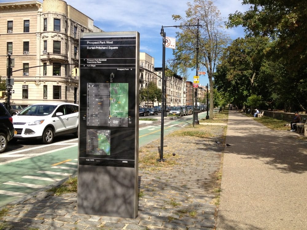

The Department of Transportation recently installed a WalkNYC wayfinding kiosk on Prospect Park West at Bartel-Pritchard Square, as part of its city-wide rollout that began in a few select locations this past summer in an effort to create a better system of signage for pedestrians.
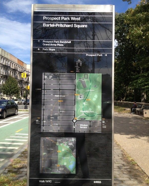
Unlike some maps where north is at the top, these are oriented so that the direction that you’re facing is at the top. They note how long it will take to walk to certain places (5 minutes to the Prospect Park Bandshell, 22 minutes to the subway at 4th/9th), locations of the nearest public bathrooms and subway stops, plus icons to let you know that there are places to eat and shop behind you on PPW, and down on 5th and 7th Avenues.
Seems like a nice idea, though we wonder what will happen when they need updating (for instance, how handy would it be to note Citibike locations, if we ever get some?). And do you think this means we’ll have fewer opportunities to give directions to lost tourists?


