
Crowdsourcing Traffic Safety: Help Map Local Traffic Problems

Back in April, the city launched an interactive Vision Zero map for neighbors to get involved with making street conditions safer. The map allows you to pinpoint problematic roads and intersections, reporting a range of conditions including double parking, frequent speeding, irresponsible cycling or even crosswalk timers that take too darn long.
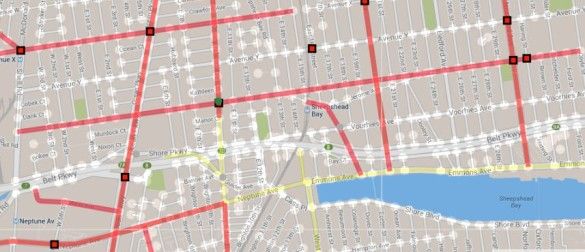
Reader Daniil S. put it back on our radar this week, causing us to note that, well, no one in Southern Brooklyn appears to be paying attention. Dots cover the map in Manhattan and northern Brooklyn, but scrawl down to below Avenue H and there’s hardly a single report.
That’s cause for concern, because its the frequent cry of both drivers and pedestrians in Southern Brooklyn that the Department of Transportation goes ahead and implements plans from the top down, implementing ideas that may work well for midtown Manhattan but not so much for quiet, residential and car-dependent neighborhoods. And, yet, when given the opportunity to map out where the real problems are… nothing?
Daniil writes, “I
f you can encourage everyone on the blog to tag our intersections and we outnumber the other neighborhoods in the city in complaint count, it might just make our streets a bit safer.”Indeed. Let’s give that a try. Find the map here.


