
Spotted: Google Maps Car In Caton Park


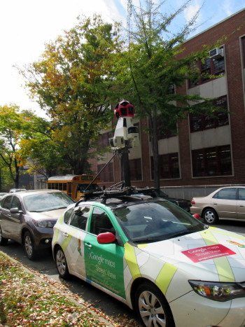
Neighbor Brenda snapped this Google Maps car yesterday, she says, “parked right outside our house and peering at us!” It’s always fun and sort of awkward to see these around (hopefully you won’t be caught walking down the street on a bad hair day), and we got to thinking about where in the area really ought to be updated.
There is, of course, 1216 Albemarle Road, which is becoming more house-like by the day but still looks like this in street view.
There’s the intersection of Westminster Road and Ditmas Avenue, which lacks the traffic light in street view that it recently gained in real life.
And there’s the intersection of Church Avenue and E 17th, that shows the Church Bargain Center from one angle (from a 2007 photo), but the more recent and accurate Downtown Brooklyn Natural from another.
What other areas in the ‘hood could use updating?


