
Sorry, Robert Moses – City Wants to Cover Parts of BQE With a Park


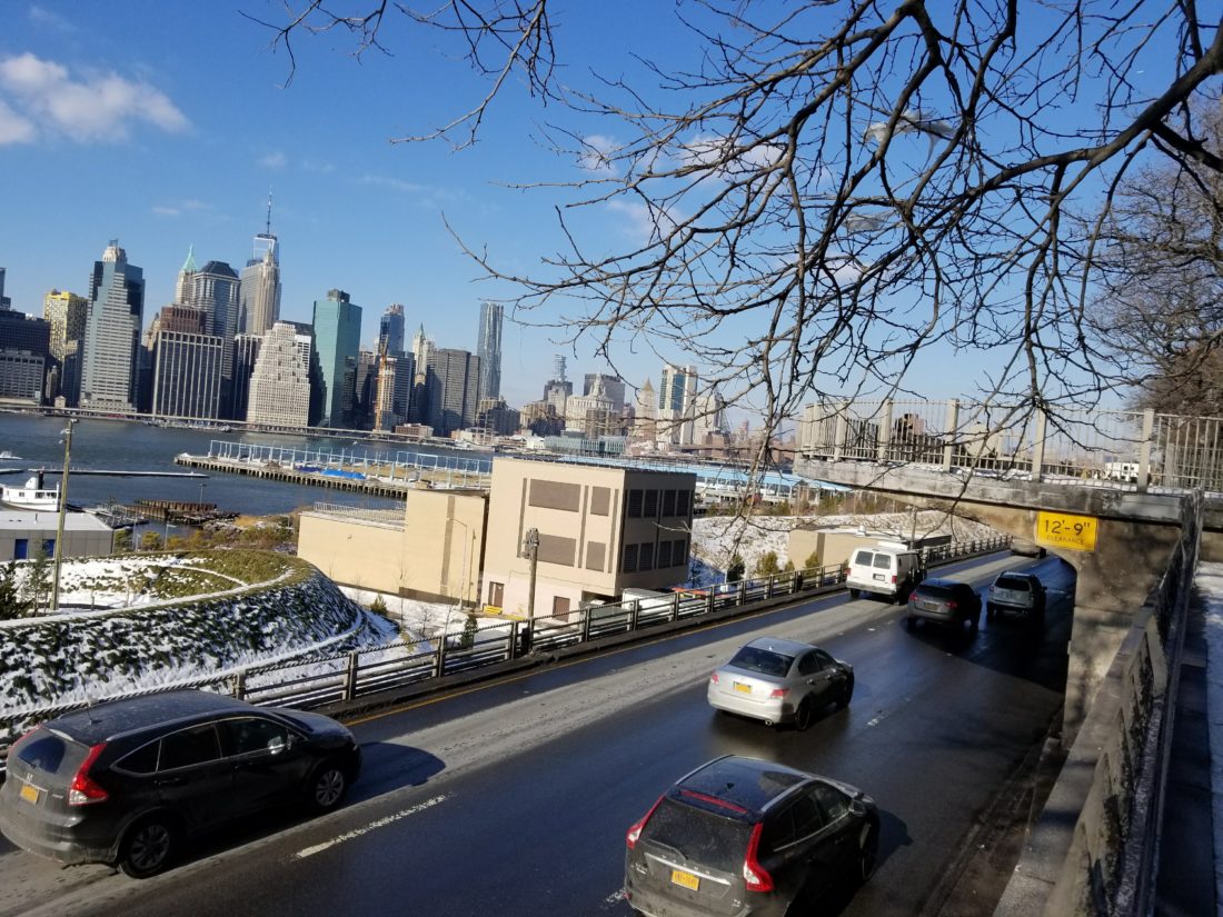
A 1.5-mile section of the Brooklyn-Queens Expressway (BQE) is in danger of collapsing, and officials are frantically trying to come up with options – affordable, and futuristic. Experts give the triple-cantilevered section, the stack of three levels that juts out toward the East River, just 6 years before it is considered unsafe to use.
BQE, as its name suggests, connects Brooklyn and Queens, and carries over 150,000 vehicles daily, including trucks. When it was built in the 1940s by public official Robert Moses, it infamously sliced through neighborhoods throughout the city. Now, it’s a prime example of the city’s aging highway infrastructure.
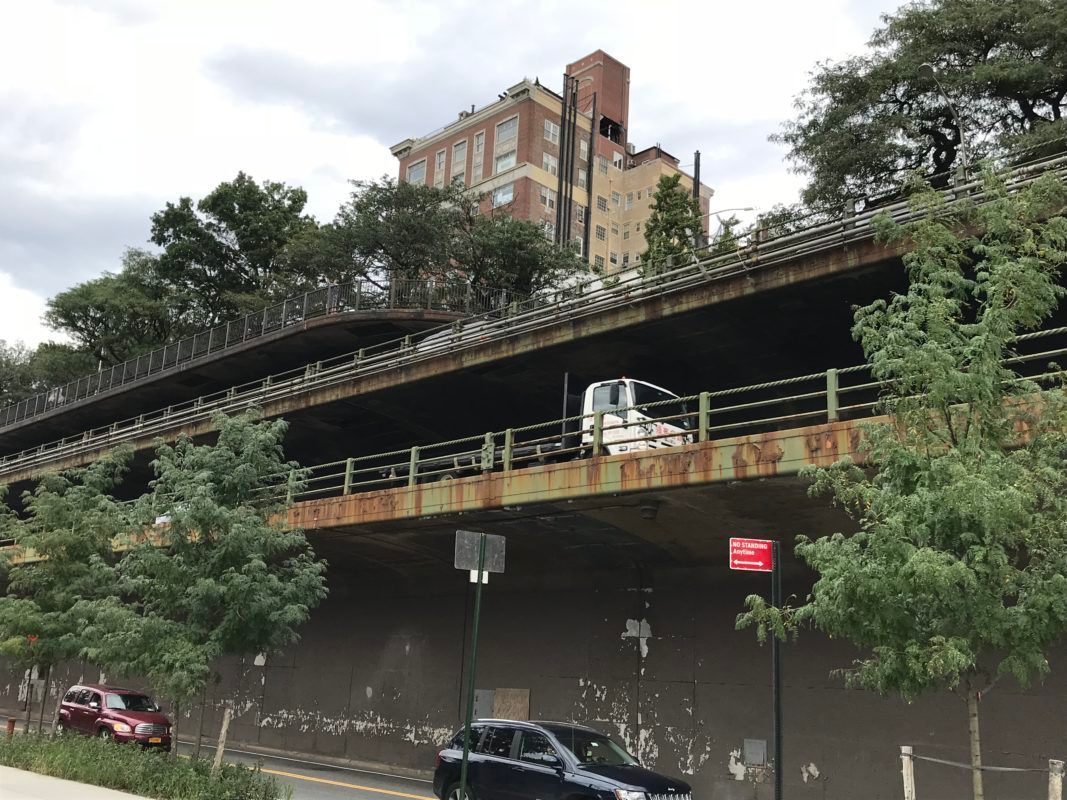
Highways like the BQE were built long before basic safety standards dictated the construction of the city’s highways, Adam Foreman, a member of the comptroller’s policies team explained at the meeting. The BQE, in particular, consists of a number of sharp curves, narrow lanes, no shoulders, and poor sightlines. Because of these issues, parts of the BQE, including the 1.5-mile segment between Atlantic Avenue and Sands Street, have a high crash rate. On top of that, road salt seeping through cracks in steel rebars inside the Brooklyn Heights section’s concrete walls are causing the walls to corrode.
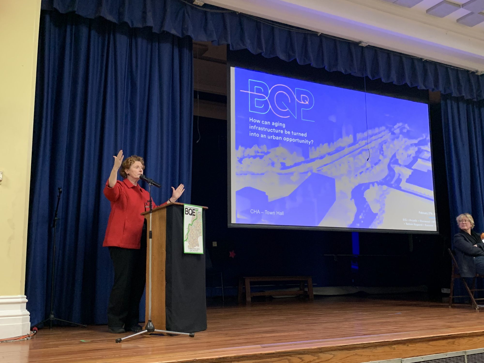
Last night, a panel of representatives and designers gathered in the auditorium of PS 29 on Henry Street in Cobble Hill to present possible plans for the rehabilitation of a 1.5-mile section of the BQE, which also includes a trenched section of highway that runs through Cobble Hill and Carroll Gardens.
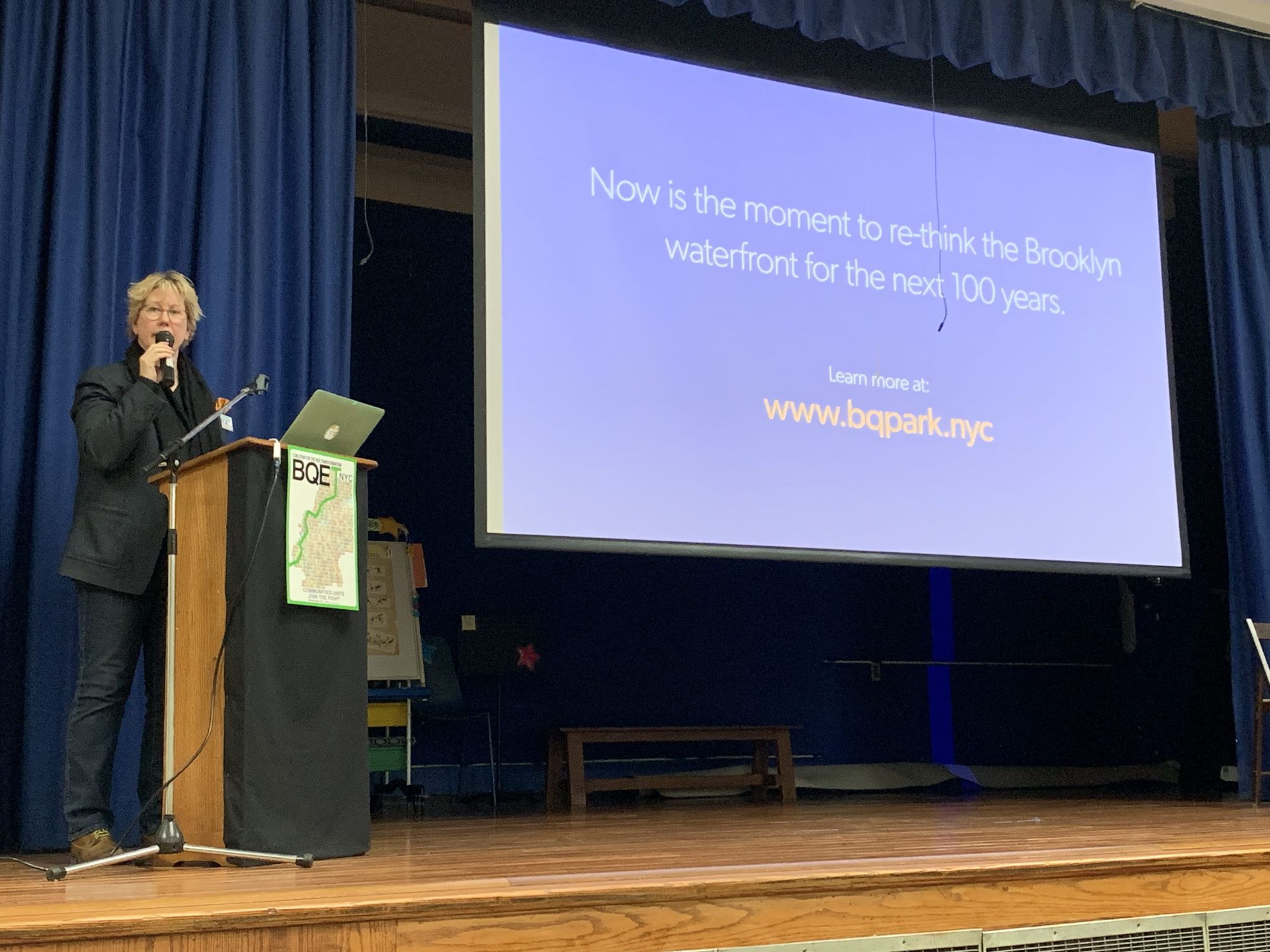
We need a “transformative, sustainable solution that will permanently change the relationship of the expressway to our adjacent neighborhoods,” President of the Cobble Hill Association Amy Breedlove said, kicking off the panel organized by the association. That solution must protect neighborhoods and parks, Breedlove said, as well as “emphasize the neighborhoods’ historic character, and enhance pedestrian connectivity and green space.” The panel included local elected representatives Senator Brian Kavanagh and Assembly Member Jo Anne Simon, design expert from Bjarke Ingels Group (BIG) Jeremy Siegel, and Cobble Hill Association board member Josh Vogel.
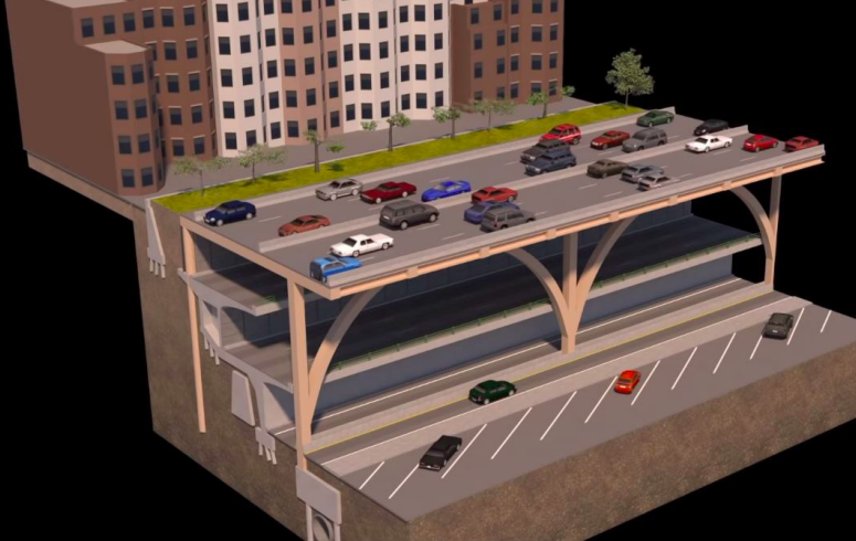
The Department of Transportation (DOT) released its original plan for rehabilitation of this stretch of the highway back in 2016, and estimated the project to cost $1.7 billion. DOT later revealed two new, more expensive proposals in September 2018, the first of which would have taken eight years and cost $3.4 to $4 billion, involving crews working incrementally, lane by line. The second proposal called for demolishing the Brooklyn Heights Promenade and building a temporary elevated roadway in its place, costing $3.2 to $3.6 billion and taking approximately six years while repairing the existing highway.
There are alternative plans that have been floated of how best to go about the situation, from demolishing, to decking over the trenched portions of the expressway, to building a park over the cantilever, to drilling a tunnel beneath. This week, City Council Speaker Corey Johnson released the report city council commissioned of the engineering and design firm Arup to review the various options.
Based on Arup’s recommendations, the City Council decided to narrow the pool of options down to two plans: a capped highway, which would involve building a deck over a street-level roadway and allow for an expansion of Brooklyn Bridge Park, at an estimated cost of $3.2 billion; or a tunnel bypass, which would cost roughly $11 billion but would allow for the removal of the expressway through Cobble Hill, Brooklyn Heights, Dumbo, Fort Greene, and Clinton Hill, allowing for options like more parks and bicycle lanes.
The city rejected the tunnel proposal due to financial and logistical challenges, the New York Times reported earlier this week.
It is a massive win for the Brooklyn Heights Association who campaigned aggressively against even the temporary demolition of the Promenade. But the debate over a better plan continues.
Stringer’s proposal, created with consultation from engineering firm Stantec, goes further than the city’s current park over cantilever proposal and would convert both the cantilever and the trench portion that runs along Hicks Street in Cobble Hill and Carroll Gardens into a truck-only highway, topped by a two-mile park.
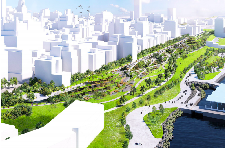
Jeremy Siegel of BIG presented a series of ideas for how infrastructure like the BQE can perform multiple functions, such as transforming the existing cantilever structure into parkland, or deconstructing the cantilever and transforming it into parking.
Both plans would include a corridor for public transit. While the visual Siegel presented displayed a six-lane corridor, he said that they fully support the notion of reducing the number of lanes down to four to make it cheaper and more feasible to complete. The first of the plans would provide a seamless transition between Brooklyn Heights and Brooklyn Bridge Park via a slope built over the cantilever, obliterating the existing gulf between the park and the neighborhood.
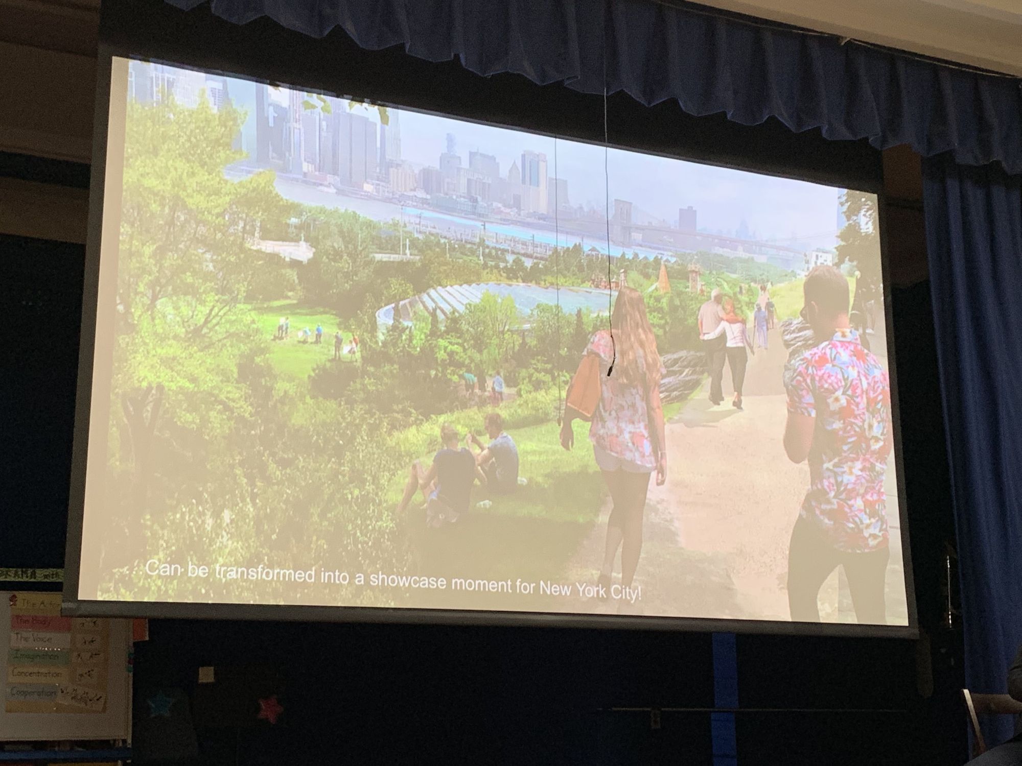
During his presentation, Siegel showed projected images of pedestrians strolling over a promenade overlooking an idyllic piece of sloped parkland, with the city skyline in the background.
While the plans ranged in scope, panelists all agreed: we can’t just restore the BQE to what it was in the 1940s. The rehabilitation must align with the city’s move toward safer and more sustainable infrastructure, that cuts down on highway deaths, noise and air pollution, helps connect disparate neighborhoods, and provides public parks and greenery.
Politics & Next steps
To put any of the proposed plans in action, Assemblymember Jo Anne Simon explained, both the state and the city need to be part of the conversation.
The city council held a public hearing earlier this week on BQE, during which DOT Commissioner Polly Trottenberg said that she couldn’t imagine a path forward for the BQE rehabilitation without state cooperation, Curbed reported. Arup’s report recommended that the state Senate and Assembly create legislation that would “create equal partners in the City and State, and identify broad goals for the corridor related to transportation, community engagement, the public realm, and sustainability,” which Trottenberg agreed with.
Senator Brian Kavanagh echoed this idea. “It’s been clear from the beginning that nothing very good is going to come of this — and certainly nothing optimal is going to come of this — unless we find a way to have genuine and serious engagement and coordination and cooperation among all offices of government,” including both the city and the state government, said Kavanagh. Kavanagh also spoke to the issue of heavy trucks on the stretch of BQE, which, he said, has spurred the city to think about how issues like overweight truck traffic can be deterred in order to “extend the useful life of the infrastructure.”
Linda Blyer, a Cobble Hill resident for nearly 40 years, told us after the meeting that she really liked the proposed idea of a park covering the triple-cantilever structure, which would make it easier to get up to Brooklyn Heights from Brooklyn Bridge Park. “Now, you can only get to Brooklyn Heights from Atlantic Avenue, or the other end,” Blyer said. “It’s nice to have more access.” In addition, she said “It’s just nice to have more green space.”


