
Share Traffic Safety Concerns On Vision Zero Map


The city is looking for your input about traffic safety issues with its new interactive Vision Zero map.
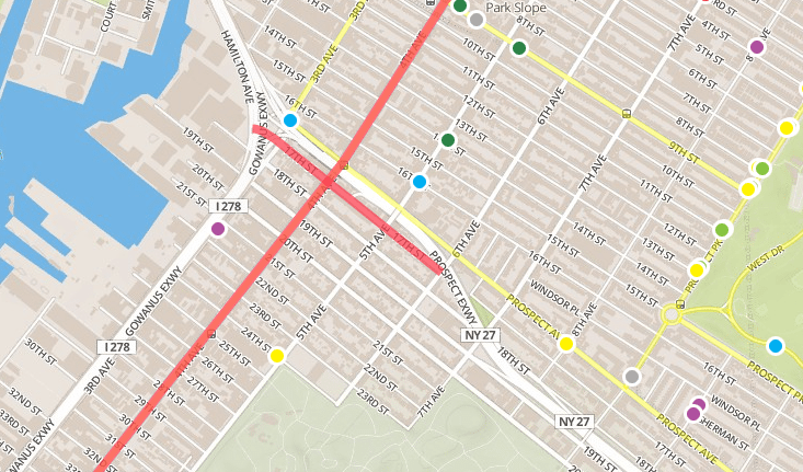
Since it went up, users have already added a number of markers around the city, with reports ranging from poor visibility to speeding, jaywalking, double parking, and more. The map also highlights the streets that are in the top 10% for crashes in each borough, and marks intersections that have seen pedestrian fatalities going back to 2009.
There aren’t too many items on the map in our area yet, though there a a couple reports of double parking — outside Steve’s C-Town and the Joseph G. Duffy funeral home on 9th Street, and along 5th Avenue near 14th Street — as well as failure to yield reports on Prospect Ave at 8th Ave and on 5th Ave at 24th Street.
It’s pretty easy to use — you can log in through Twitter or Facebook, or add issues anonymously — and you can do it from your smartphone while you’re out in the neighborhood noticing things.
“Your knowledge will be used to create a traffic safety plan for each borough that will describe how to make each borough’s streets safer for everyone, whether walking, biking, or driving,” reads the about page. In addition to the map, you can also attend upcoming workshops to provide input.


