Photos: Kings Bay Rising, Circa 1960’s – A Requiem For Sheepshead Bay
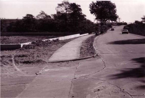
Longtime reader Bruce Brodoff sent me these photos way back in January 2010. We had a couple of e-mail exchanges about them, and what follows is a photo essay and narrative pieced together from those e-mails describing the Kings Bay-area of Sheepshead Bay being developed. They show Kings Bay Little League’s fields being constructed, along with the Seacrest Apartments, and illustrate how parts of the neighborhood were – in relatively recent memory – still rural. His writings memorialize a bygone era; a quiet, uncongested corner of Brooklyn yet to be developed. Brodoff shares his memories of growing up in the type of neighborhood that New York City will likely never know again.
My family moved to Sheepshead Bay in 1966 into the newly-constructed Seacrest Apartments on Shore Parkway, next to the Golden Gate Motel and the Kings Bay Little League baseball fields. We moved when I was just three-and-a-half years old, and I am a proud product of P.S. 52, Shell Bank Junior High School and Sheepshead Bay High School (Class of 1979).
A few years ago Lou Spina, the Chairman of Kings Bay Youth Organization, shared with me a bunch of incredible photos of the baseball fields being constructed in the early 1960s. The photos also feature Seacrest being built, and some other perspectives of the neighborhood that are very striking.
The Bay was pretty undeveloped until a few decades ago. My parents remember walking on planks in front of the Seacrest building on Shore Parkway in early 1966 because there were no sidewalks; they were original tenants in Seacrest when they moved in June 1966. Sheepshead Bay was an amazing place to grow up – I lived a couple of blocks from Plumb Beach and spent countless childhood hours walking the shoreline looking for horseshoe crabs and other marine life; I remember playing on the construction site of the two-family homes that were built on Bragg Street between Emmons Avenue and Shore Parkway in the early 1970s; I remember that the ground was always muddy, and I believe that’s because the old “Hog Creek” meandered along that stretch of the neighborhood on its way to Shell Bank Creek.
Way before the Comfort Inn at the end of Emmons Avenue was built (on the site of the old Groto D’oro restaurant, which looked like a rustic cabin along the water), there was a a little building that housed a “Shatzkin’s Knish,” which briefly turned into a Nathan’s hot dog place. I think that even before this the site was home to a Bohack’s supermarket, although it might have been a bit further west, where the Palm Shore Home for Adults is, and land that now supports the very ugly Best Western on the corner of Emmons Avenue and Nostrand Avenue used to feature a very rural-looking gas station.
Where the Sheepshead Bay movie theater now stands once stood the Deauville Swim and Tennis Club; it was a pretty amazing place, especially in the winter, when they erected a big “tennis bubble” so people could play indoors. I played there for many years as a kid, as the Kings Bay sports league offered a tennis program. I always loved walking to the bubble along the Shore Parkway service road in the evening, as it was a mysterious walk – it was pretty desolate, and I always looked across the Belt Parkway at the Rockaway Inlet and watched the buoys and the towers of the Marine Parkway bridge blinking their red lights.
The back area of the Deauville (around where Jordan’s Lobster Dock is right now) was pretty rural back then. If you hit your paddleball over the fence, you had to wade through thick brush to find it, and the few homes that are still there were something out of a small fishing village.
The Bay just seemed bigger, brighter and cleaner when I was growing up. There were no safety railings along the water, just the sidewalk and perhaps a foot high – maybe less! – little curb separating pedestrians from the water below. I also remember how packed Emmons Avenue was when the boats returned from the sea in the late afternoon; every pier had a boat, and every boat was overflowng with fish on display for sale. It was very exciting to see the water, the boats, the birds, all the people buying and negotiating, and hearing the fog horns blaring and the shouts of fishmongers on the piers. I still love experiencing it, even if the fleet is now pitifully small and the Bay has lost its old-time feel.

Looking east on Shore Parkway (That’s the Golden Gate behind the trees and the Deauville in the background), but I’m not sure if the photographer is standing on Coyle street with the empty lot being the ball field, or if he is standing on Bragg Street and the lot is the future 3845 building. That fire hydrant was in front of the building pool, so it’s possible that the cluster of trees soon became the building I lived in. If the lot is the ballfield, then Bragg Sstreet is behind the far border and all of Seacrest was built on that former forest.
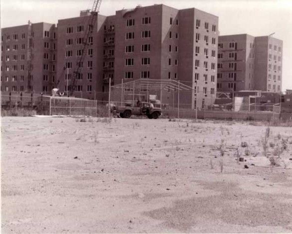
Here are the 3080/3090 Voorhies Avenue buildings. Bragg Street runs between the field and the buildings. The photo was taken near the corner of Coyle Street and Shore Parkway.
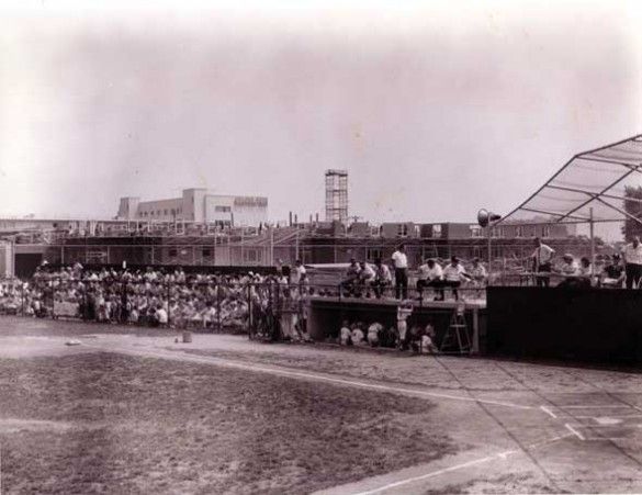
The first few floors of the 3845 building rising. That’s probably the elevator shaft (or garbage chute?) in the middle. The Golden Gate Motel is in the background.
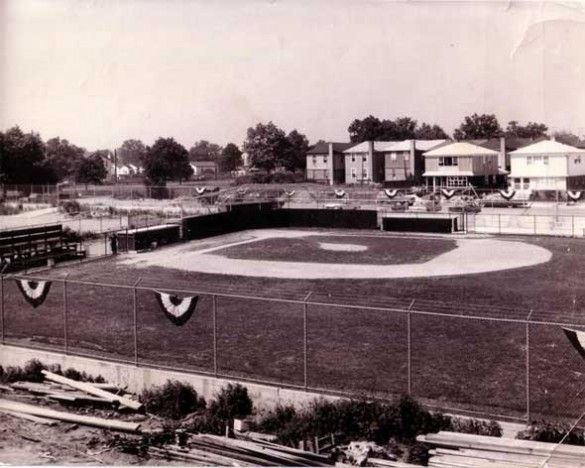
Bragg Street in the foreground, the brand-new baseball field, and Coyle Street and it’s new houses in the background.
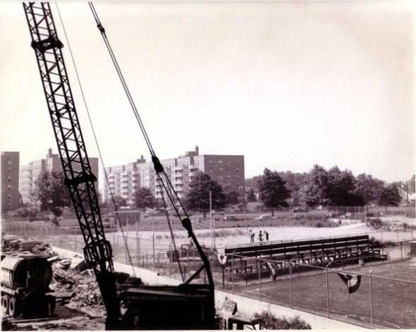
Bragg Street between Shore Parkway and Voorhies Avenue in the foreground, Shore Parkway and the Belt Parkway in the middle, the Lefrak apartments between Emmons Avenue and Shore Parkway in the background. I love the “forest” on the far right; I have distinct memories of when the neighborhood was still kind of wild in the late 60s/early 70s.

