
New Neighborhood Maps — DOT Wayfinders — Are Arriving In Fort Greene-Clinton Hill


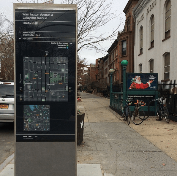
If you’ve ridden the G train to or from the neighborhood in the last week, you might have noticed a new addition to the sidewalk: a tall, shiny directional map — one of the city Department of Transportation’s (DOT) Wayfinder walls.
A regular sight in tourist destinations throughout Manhattan and parts of Brooklyn, such as Downtown Brooklyn, these standalone maps have been making their way further inland to parts of Flatbush, Ditmas Park, and other neighborhoods in recent months.
The wayfinders are part of the DOT’s WalkNYC initiative, which aims to provides additional way-finding for people — tourists and natives alike — who might be visiting areas they are not familiar with.
According to the DOT,
WalkNYC signs provide valuable information, from basic cardinal directions and street names to mapped details like subway entrances and Wi-Fi hotspots. The maps are rotated “heads-up” or forward-facing to show the street network as it appears in front of you. Research and user testing demonstrate that this method is more accessible for people who are unfamiliar with their surroundings or have trouble reading maps.
The DOT says to send any questions or concerns to walknyc@dot.nyc.gov.
What do you think of the new signs?


