
Major Bike and Pedestrian Improvements Planned for Meeker Avenue


The city’s Department of Transportation unveiled plans for a revamp of Meeker Avenue in north Brooklyn last night, including a new two-way bicycle and pedestrian path, dedicated left-turn signals, and other safety improvements.
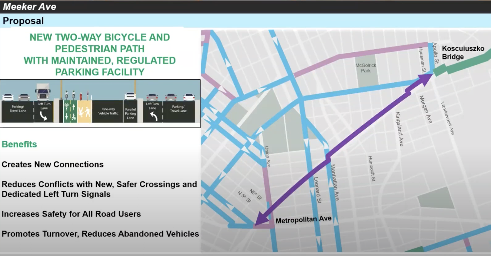
At a virtual meeting of Brooklyn Community Board 1’s transportation committee Tuesday night, Craig Baerwald, the Operations Manager for DOT’s Bicycle Program, said the goal of the intervention is to improve safety on the historically dangerous avenue and to add connections for pedestrians and cyclists between the newly-revamped Kosciuszko and Williamsburg Bridges, as well as the Williamsburg-Greenpoint neighborhood between them.
“This represents a huge gap in the network,” Baerwald said.
Meeker Avenue, which runs under the Brooklyn-Queens Expressway, is one of DOT’s Vision Zero priority areas. In a five-year span stretching from 2014 to 2018, 10 people were severely injured in crashes on the street and one was killed, according to DOT data, putting Meeker in the top third of the borough’s most dangerous corridors. Crashes caused 208 total injuries during that time span.
Safe streets advocates like Transportation Alternatives have pushed for years to have the street redesigned, and in 2017, DOT organized a community engagement session to discuss changes to the area.
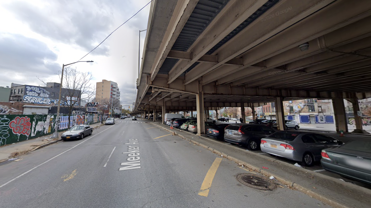
The avenue sustains a mix of commercial, residential and industrial uses along with a series of parking lots. The lots themselves are not connected by crosswalks, Baerwald said, and are plagued by abandoned vehicles and illegal dumping. The roadway also offers little to no dedicated space for cyclists or pedestrians.
To change that, DOT is looking to repurpose “about half” of the approximately 680 parking spaces along the Avenue to create a dedicated bike and pedestrian space underneath the bridge, Baerwald said. The agency also wants to add left-turn signals to “reduce the conflict and allow for safer new crossings down the center of the parking fields here.”
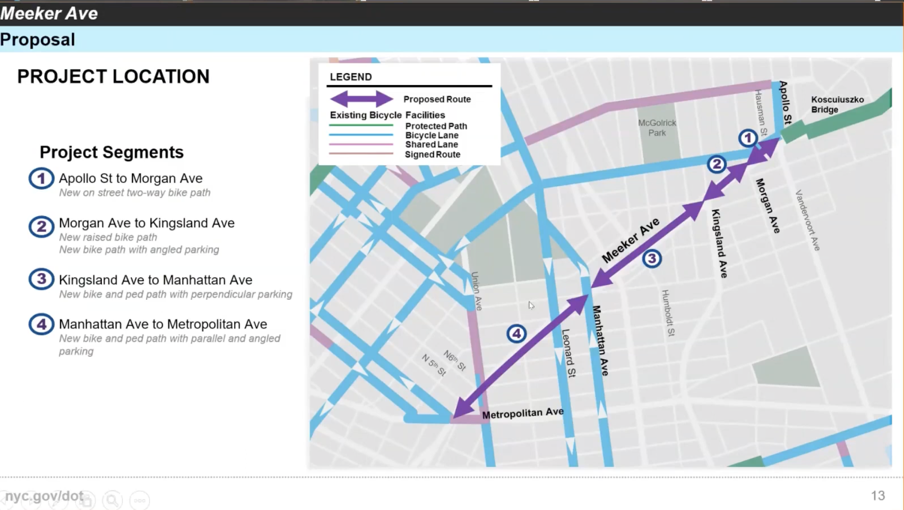
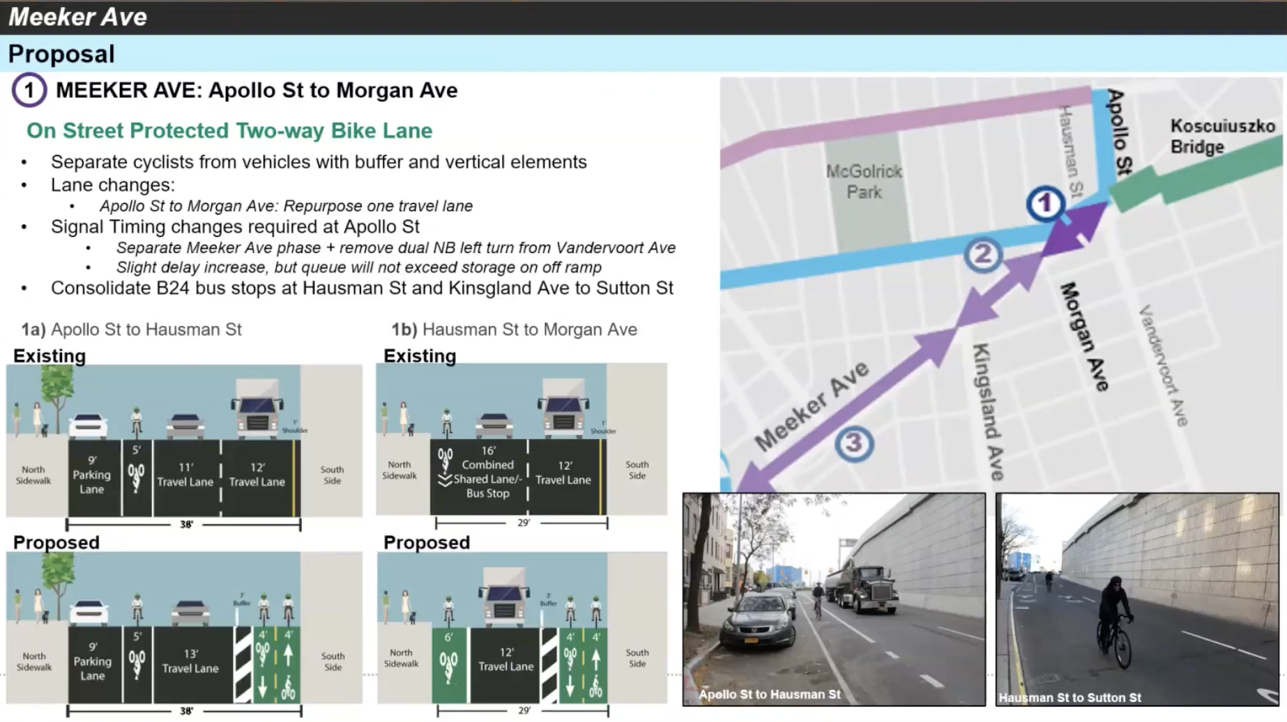
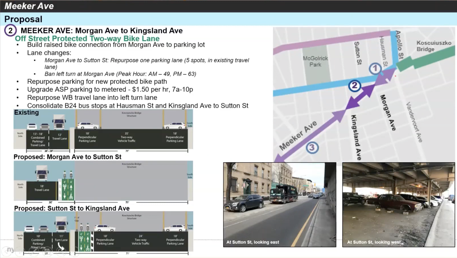
The proposed redesign, which stretches slightly over a mile, would be broken up into four sections, with slightly different interventions in each. From Apollo Street to Morgan Avenue, one vehicle lane would be removed to create a new, 8-foot-wide, two-way bike path. Two B24 bus stops, at Hausman Street and Kingsland Avenue, would be consolidated to one at Sutton Street.
The second stretch, from Morgan Avenue to Kingsland Avenue, and Kingsland Avenue, would repurpose a parking lane to a two-way bicycle path that then diverts onto a parking lot under the BQE structure at Sutton Street. Left turns onto Morgan Avenue would be prohibited.
The intersection at Meeker Avenue and Kingsland Avenue would also be redesigned with new signal phasing, concrete and street markings.
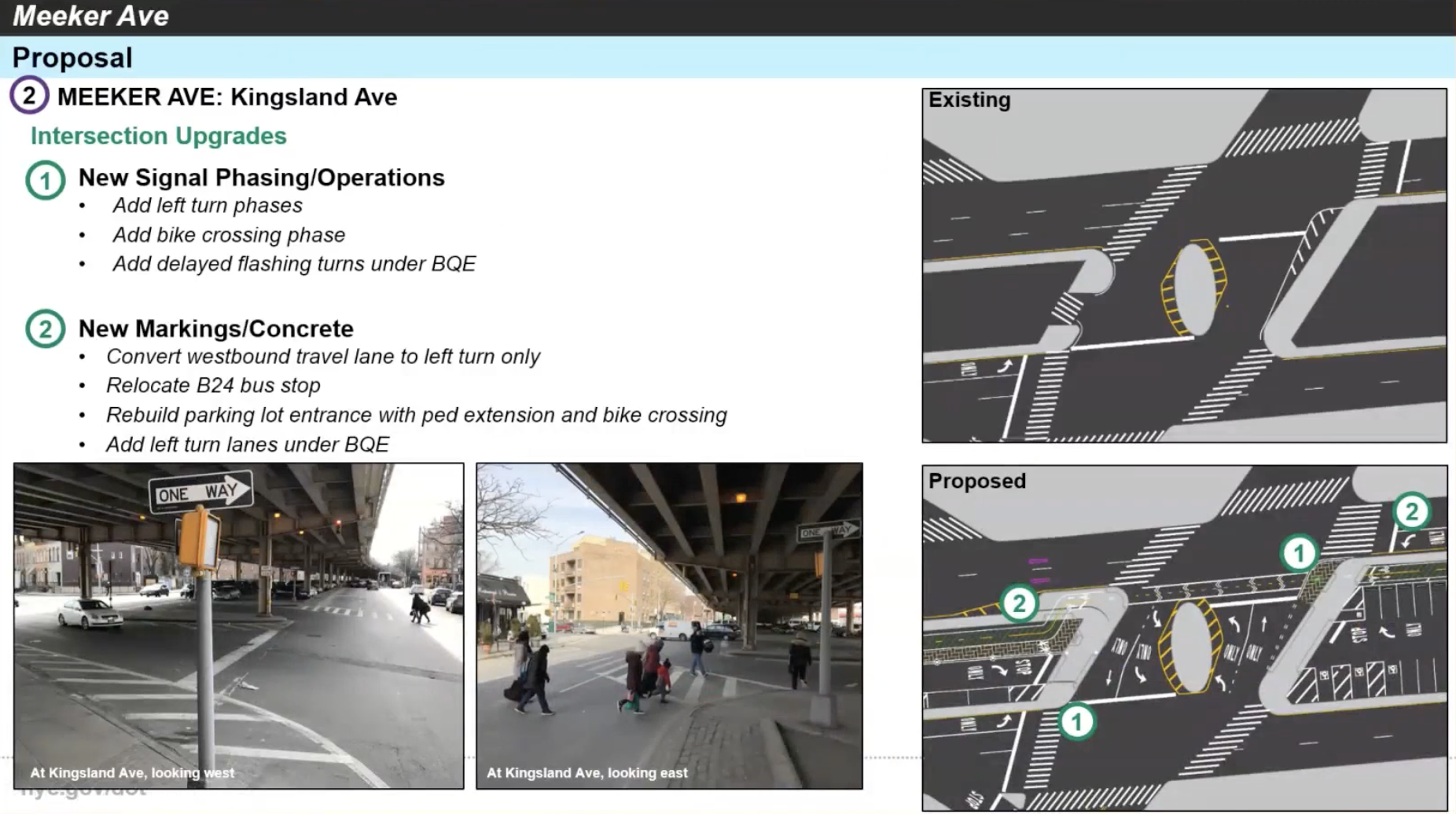
Other major intersections along the thoroughfare west of this point will get similar redesigns.
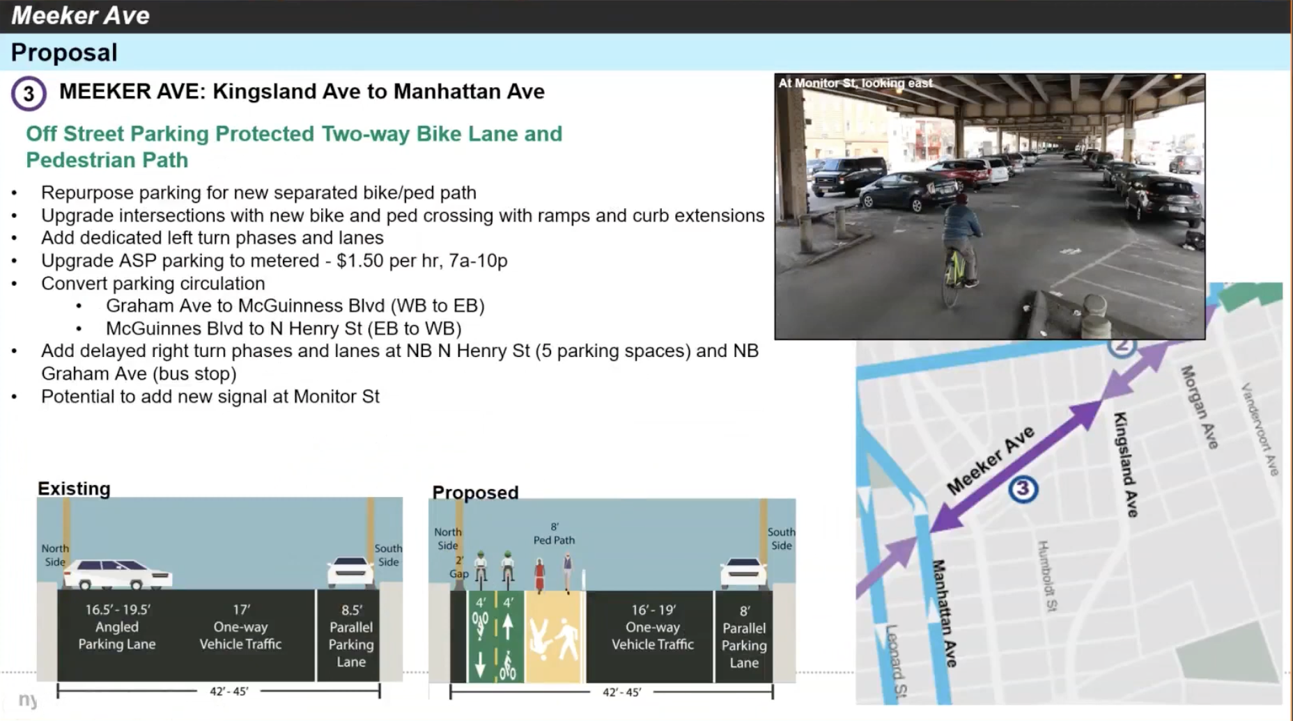
The third section, from Kingsland to Manhattan avenues, would see off-street parking repurposed to continue the two-way bike path and the addition of a dedicated, 8-foot-wide pedestrian space. Dedicated left-turn lanes and signals would be added for vehicles along the stretch, and delayed right-turn signals and lanes would be added on North Henry Street and Graham Avenue for vehicles turning onto Meeker Avenue.
In the final stretch, from Manhattan to Metropolitan Avenue, the parking lots become much wider, and DOT plans to retain both parking lanes under the BQE while also making space for the bike and pedestrian paths to continue on the south side of the lots by converting the vehicular thru-space in the lots from two-way to one-way spaces.
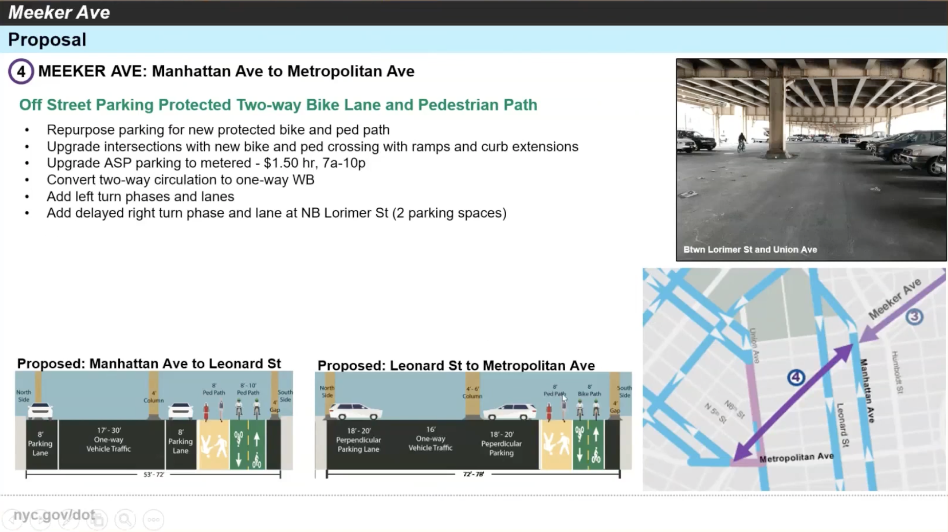
Unlike most of the project, this fourth stretch includes a proposal to add some parking, too: about 59 new spaces could be created from what is now a buffer zone on the eastbound side of Meeker Avenue between Union and Manhattan Avenues.
Baerfeld said the city plans to continue stakeholder engagement through the spring, with construction on the project beginning this summer, starting at the Kosciuszko Bridge end of the Avenue and working west. He estimated it would take “two seasons” to complete the entire project.
Other touches include upgraded street lighting and additional bike parking. Potential future additions to the space include dedicated space for carshare and electric vehicles, along with “long-term bike parking.”
Many committee members generally reacted positively to the proposal; Willis Elkins said at the meeting that “we’ve been asking for these sorts of improvements for pedestrians and for bicyclists for a very long time.”
But there was some pushback from attendees against the loss of parking spaces and a plan to convert nearly all the remaining parking along the stretch from alternate-side to paid metered parking from 7:00am to 10:00pm, which DOT justified as necessary to reduce abandoned vehicles and to allow maintenance of the space.
“I have finite resources to keep the parking fields and the things that we are dealing with now clean,” said Michael Marsico, head of DOT’s Bureau of Parking. “So I have to use the resources and staff where the metered parking is. That’s the way our policy works.”
Others called on the agency to ensure bioswales were installed to direct rainwater runoff in the area, and asked DOT to work collaboratively with the city’s Sanitation Department, Department of Homeless Services, and NYPD to better maintain the street and provide service to individuals that sometimes gather under the overpass to use drugs.
“I think we need to hold these agencies accountable,” said Board member William Vega.
Ultimately, the committee voted to recommend approval of the project. The plan will be voted on by the full Board, which plays an advisory role on such projects, at a virtual meeting on Tuesday, May 11th.


