
Highlight Dangerous Ditmas Park Streets With An Interactive Vision Zero Map

The city is looking for your input about traffic safety issues with its new interactive Vision Zero map.
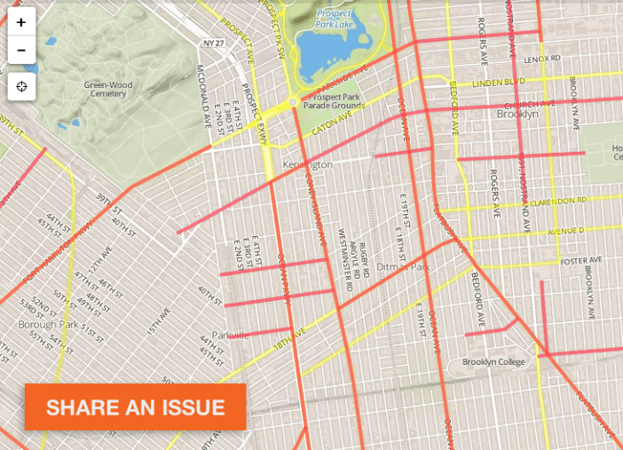
Since it went up, users have already added a number of markers around the city, with reports ranging from poor visibility to speeding, jaywalking, double parking, and more. The map also highlights the streets that are in the top 10% for crashes in each borough, and marks intersections that have seen pedestrian fatalities going back to 2009.
It’s pretty easy to use — you can log in through Twitter or Facebook, or add issues anonymously — and you can do it from your smartphone while you’re out in the neighborhood noticing things.
“Your knowledge will be used to create a traffic safety plan for each borough that will describe how to make each borough’s streets safer for everyone, whether walking, biking, or driving,” reads the about page. In addition to the map, you can also attend upcoming workshops to provide input.


