Bus Service Cut Sagas: DOT Screws Up Again

The following op-ed is by Allan Rosen, a Manhattan Beach resident and former Director of MTA/NYC Transit Bus Planning (1981). For a complete list of his contributions to Sheepshead Bites, which includes many articles about the bus cuts, MTA and DOT, click here.
The Department of Transportation promised to update all bus stop signs within three months of the massive June 27 bus service cuts, which included the loss of the B4 east of Coney Island Hospital during “off-peak” hours. It appears they are ahead of schedule with most of the sign changes already completed. But how good of a job did they and the MTA do?
Don’t expect every sign to be correct. Some always fall through the cracks. For example, although Sunday meters ended several years ago, there are at least two places in Brighton Beach (and who knows where else) that the signage still indicates that meters are in effect on Sundays. On the bus side, there are still two or three locations in southern Brooklyn where bus maps are still posted for routes that have not run in over thirty years, one for the original B1 and the other for the B21.
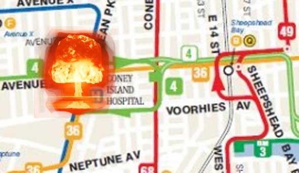
The MTA made a bigger mess by placing the terminal stop for the B4 not at Coney Island Avenue but at Coney Island Hospital. That means that one can only transfer to the B68 from the B4 but not from the B68 to the B4 during the hours it does not continue to Knapp Street. Had the terminal been placed at Sheepshead Bay Station, additional transfers would have been available to the Brighton line and the B49 Ocean Avenue bus as well, and it may not even have costed any additional money to operate since it would have not been necessary for the bus to loop around the hospital when the bus goes to Knapp Street.
Worse yet is the confusion this change entails. On September 1, I noticed a B4 driver asking everyone to leave the bus at its “last” stop, Avenue Z and Coney Island Avenue. About eight people got off, all very confused that the bus was not going further. So I checked the new Guide-a-Ride maps, the technical name for those square boxes showing maps and schedules (prepared by the MTA and placed by DOT), and was surprised to see no differentiation made between Coney Island Avenue bound trips and Knapp Street bound trips. It did not even indicate which trip was the first one to Knapp Street, which occurs sometime around 2 p.m.
The map shows the portion east of Coney Island Avenue in a faded blue (which will probably disappear when the entire map starts to fade) and a note that Knapp Street service is provided during rush hours only which is clearly incorrect. Not much effort is involved in making the information correct. Other Guide-a-Rides differentiate between partial trips and special school trips by placing a letter suffix after the schedule time, so it is technically possible to do this. A lower case “k” after the schedule time and a footnote would have provided much needed information. However, apparently the MTA planners just don’t care or are too stupid to notice this omission.
It is also questionable if passengers are permitted to stay on the bus during its layover, when the bus terminates at Coney Island Hospital, to allow passengers to transfer in both directions from the B68. My guess is that some drivers allow it and others do not. It should be required if no further changes are made to this route since it makes no sense to have a one-directional transfer.
There are signage problems with the buses as well. At least one bus, Bus #5107, is still running around without updated signage. It operates on the B1 and still indicates that the route uses 13th Avenue which is no longer the case. Since there is no sign for a 4th Avenue destination, drivers use the Kingsborough sign in both directions. To make matters worse, not only is the signage on this bus incorrect due to the changes of June 27, apparently it was never correct since it reads “B1 via 13Av – via 85 St to Kingsboro Coll Manhattn Bch” not “86th Street.”
When the switch to all digital signage from roll signs was made in 1980 at a great expense ($3,000 per sign as compared to $500 for a roll sign, the costs in 1980), the touted benefit was the ease of making “instantaneous” changes to signs as a result of route changes. (It also requires a larger staff to maintain the electronic signs than the roll signs.) Previously, roll signs had to be spliced or new ones manufactured. Also, the signs had to be manually removed and replaced whenever buses were moved between depots. The electronic digitals were supposed to be consistent on all buses in the system so any bus could operate at any depot saving labor costs.
However, that is not what happened. Until the massive changes of June 27, it is doubtful that route changes occurred often enough to affect any real cost savings as a result of the digital changeover. The signs were also more difficult to read and suffered many mechanical problems for years until they were “perfected.” Also, it never took over two months to make changes to the roll signs, and the bus signage throughout the system is not as consistent as it was supposed to have been. As noted by someone who calls himself “5express” in a BusChat comment stated, “Often when the buses are flashed, the buses that are off site due to work or various other reasons do not get programmed. There is rarely a checklist of what has been done, but just a few guys going through the yard prior to pull out. There is no way to find out program version number until it ends up on a line that has the wrong text.”
Each digital sign has to be programmed individually, although technology exists today to do the reprogramming remotely. Labor is still involved to remove, reprogram and replace each chip. Also, typos occur which are sometimes not caught like the M15 bus that operated to “City Hell” for a few days until the newspapers caught wind of it. If more service cuts are made, that sign may have just been a premonition of the future.
Have you noticed any incorrect signage since the June 27 bus cuts? Let us know in the comments.


