
Brooklyn History One Map At A Time


On July 16, Brooklyn Historical Society (BHS) granted public access to its latest digitization effort – 1,493 maps from its collection of flat and folded maps are now available for anyone interested.
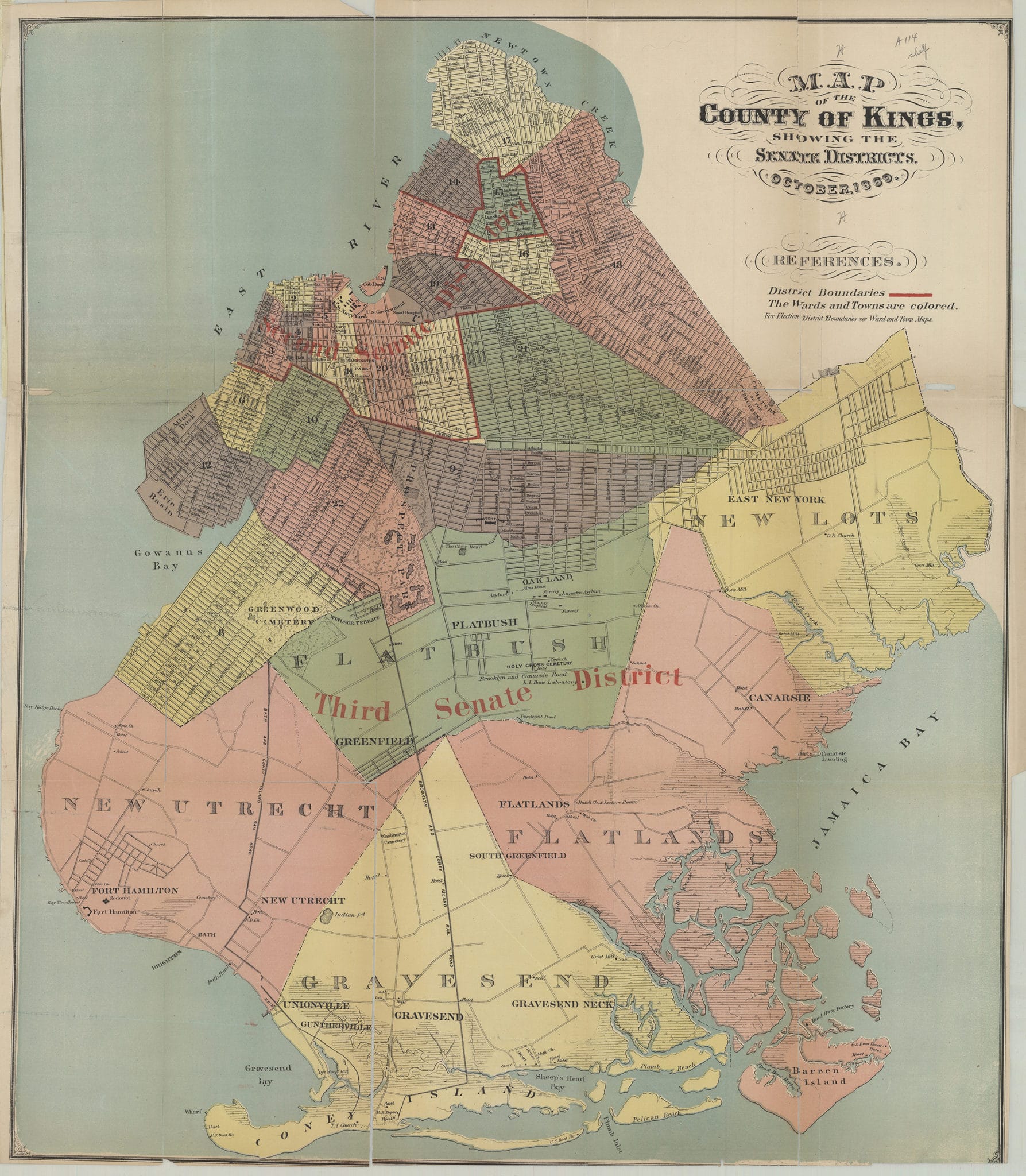
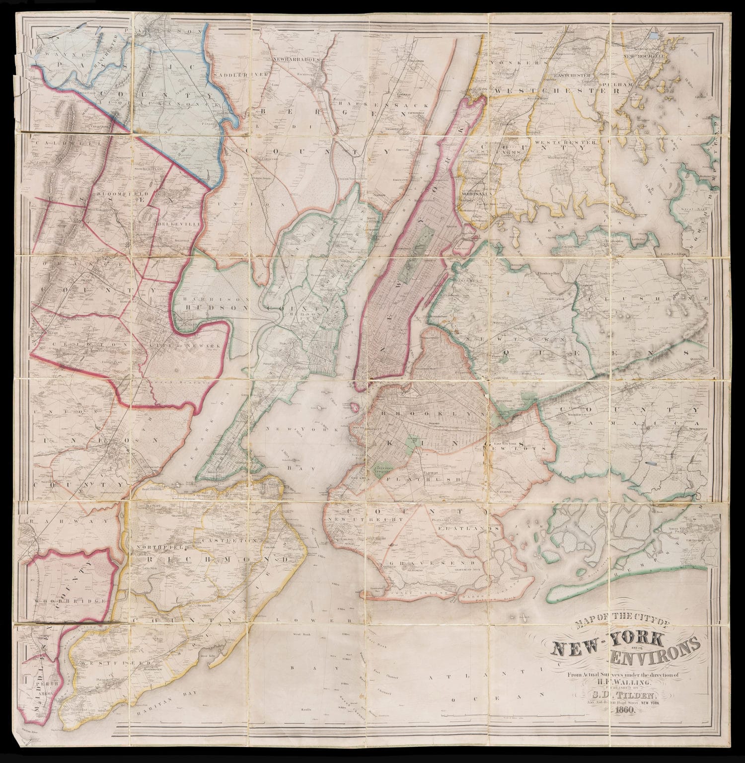
The maps date from 1562 to 2015, and are presented in an easy to search database, allowing one to sort and filter by neighborhood or town, by date or type of map. There are maps of old political districts, plans for horse-drawn railway lines and new sewers, as well as topographical maps and nautical charts. Most of the maps were donated to BHS during the 160 years its been in existence.
“Like many archives, of course, we’re interested in increasing access to our collection, and digitization is really a powerful tool for access,” says Maggie Schreiner, BHS’s manager of archives and special collections, and the project’s co-director. The project started in 2018, following the incredibly successful launch of their Oral History Portal, which allows users to search transcripts and listen to oral history recordings online, in 2016, and was made possible through funding from National Endowment for the Humanities, the Robert D. L. Gardiner Foundation and the Gladys Krieble Delmas Foundation.
“In the case of our map collection, maps are very large and many of them are quite fragile,” Schreiner explained, and during and in person visit to BHS “someone might see 10 maps over the course of this event, and it takes a couple people to bring them out. Some of them we could not show due to their extreme fragility.”
In addition to digitizing almost the entire collection, BHS also conserved and digitized ten maps that were too fragile to be handled at all, like this map dating from when the city suffered a bout of yellow fever back in 1809:
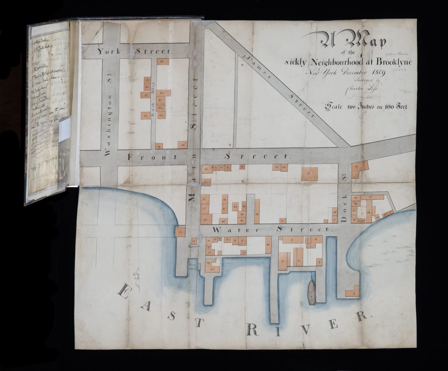
It shows an area in current day DUMBO bound by James Street and the East River, Washington Street and Dock Street. The map is accompanied by a list of people who died.
Digitization took 2.5 years and some of the 20 restored maps are still being added to the catalog.
“Our goal was to create a portal that will be used by the full range of people,” Schreiner said. “I think one of the things that’s really special about this collection is that it does a really good job of showing the evolution of Brooklyn from an agricultural region of villages to the borough. Being able to trace that evolution and all the different land transactions is something that this map port all really makes widely accessible.”
“I think also something that I found really interesting was the number of maps relating to the natural environment of Brooklyn,” Schreiner told us, and you can find deep dives on BHS blog, an incredibly accessible must-read for those interested in Brooklyn history.
The portal can be found at mapcollections.brooklynhistory.org.


