Your Flood Insurance Rate Could Spike This Year. Here’s What You Should Know


For the second year in a row, Sandy-battered homeowners are getting squeezed by the FEMA flood insurance program.
Homeowners in high-risk flood zones could see their insurance rates spike by as much as 25 percent, under new FEMA guidelines that went into effect this month. Furthermore, the Center for NYC Neighborhoods warns homeowners who let their policies lapse for more than 90 days could be taken out of the program that gradually raises their rates — potentially adding thousands of dollars a year to their premiums.
“It would be extremely unfortunate to let a policy lapse,” said Matthew Hassett, director of policy & communications for the Center for NYC Neighborhoods. “Unless you have an extra several thousand dollars that you’re looking to donate to to the flood insurance program, I would highly advise against it.”
The Center for NYC Neighborhoods is urging homeowners to check their insurance policies to see if they need to be renewed. They should also review the new FEMA flood map, scheduled to take effect in 2017, which will double the number of people living in high-risk floodplains.
This year’s increase will raise premiums for homeowners in high-risk flood zones by 5 percent. However, homes that were substantially damaged by Superstorm Sandy could have their rates jump by as much as 25 percent. FEMA has also added new surcharges for policy renewals: $25 for primary homes and second homes and businesses will be charged $250.
The rate hikes are part of the Biggert-Waters Flood Insurance Reform Act, passed by Congress in the wake of Superstorm Sandy to get FEMA’s flood program budget under control. The changes will gradually raise rates for homeowners living in flood planes — and could cause insurance premiums to eventually balloon by more than $10,000 a year.
The reformed insurance program is particularly burdensome for New Yorkers.
According to the Center for NYC Neighborhoods:
New York City, surrounded by 520 miles of waterfront, has more residents living in high-risk flood zones than any other city in the United States. Unlike most other coastal communities, the vast majority of New York City’s waterfront homes were built long before the National Flood Insurance Program’s flood maps for New York City were put in place in 1983 and special guidelines for construction were set.
In this year’s guidance about the rate increases, FEMA stated, “It is important to note that nearly 80% of NFIP policyholders are minimally impacted by [Congressional changes to the program].” Unfortunately, in New York City, that ratio is the reverse because of how many older buildings the City has: about 80% of the properties in New York City’s high-risk flood zones were built before the first flood map was adopted and they face the biggest increases in the cost of their insurance.
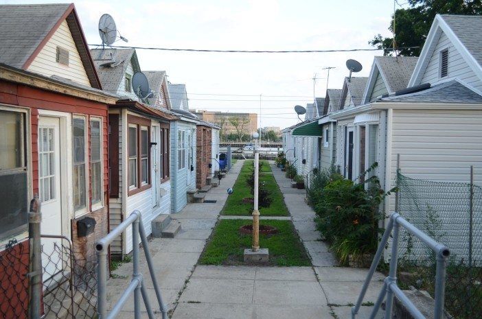
New York City has challenged the FEMA flood maps and has sponsored a study, being conducted by the Center for NYC Neighborhoods, to look into how they would affect affordability. Sheepshead Bay and Gerritsen Beach are two of the neighborhoods receiving special attention during the study. Researchers want to understand how the higher rates might make homeownership unaffordable for middle-class families in our neighborhoods.
“If this policy continues over time, it’s going to be very difficult for middle-class families to keep up with these insurance costs,” said Hassett. “We are very worried about the impact of flood insurance policies on affordability.”
Hassett explained the Center for NYC Neighborhoods is advocating for FEMA to reevaluate how they determine insurance costs. Although home elevations, which the city is scrambling to complete by the end of the year, can dramatically reduce insurance rates, there are simpler fixes: Like moving utilities to floors above the flood plain or taking valuables out of the basement.
Those who respond to the survey will get a $50 gift card as well as a free elevation certificate, which normally costs a homeowner between $800 to $1,000. The elevation certificates can be used to qualify for reduced flood insurance rates.
Furthermore, homeowners should reach out the Center for New York City Neighborhoods to find out if their insurance policies are up to snuff. They can find out more information at the center’s website or by calling 646-786-0888.
City Councilman Chaim Deutsch has also been hosting insurance information workshops at his district office to help homeowners get the right policy.
“This is about helping people find the best policy,” said Deutsch. “There are a lot of people who come in that don’t know what to do: if they need to get flood insurance, if they don’t need to get flood insurance. They might being paying for too much insurance. So we’ve brought in experts to educate homeowners.”
You will need to register in advance for the councilman’s workshops by calling 718-469-4679. The next one will be on Wednesday, April 20, from 6 – 8pm at the district office located at the corner of Avenue U and East 24th Street.


