
Central Brooklyn
Seeing Red – How Much Has Brooklyn Changed Since This Map Was Published?
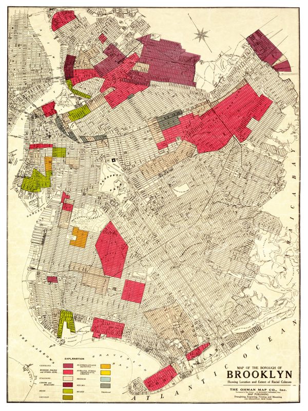
You’ve probably seen this map. It was published in 1920 by the Ohman Map Company “Showing Location and Extent of Racial Colonies” in the borough of Brooklyn. It is also a popular exhibit at the Brooklyn Historical Society (BHS) [http://www.brooklynhistory.org/blog/2014/06/30/mapping-the-first-red-scare-ohman-map-companys-maps-of-racial-colonies/] . Reasons