
What Are The Boundaries Of Park Slope?

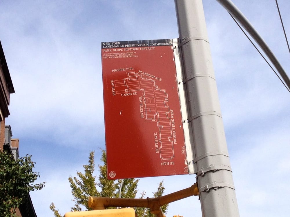
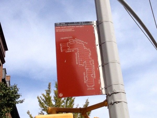
Neighborhood names and their boundaries always make for a pretty heated conversation, and neighbor Keith Williams has a pretty good conversation starter up on Curbed about the history of Park Slope borders. He asked some experts and found:
…irreconcilable differences of opinion about the neighborhood’s southern terminus: 15th Street, the Prospect Expressway, 20th Street, or 25th Street. But even more contentious are the borders between North and Center (Union Street, Garfield Place, 1st Street, or 3rd Street?) and Center and South (6th Street, 9th Street, 11th Street or 15th Street?). A few still consider what’s now debatably called Greenwood Heights as South Slope. Others say Center Slope doesn’t exist.
But a series of maps of what some of those boundaries have been over time, from 1904 to the present, are the truly fun part — check out the “no-go” zone of 1973, for instance, and think for a minute what currently exists on those blocks (institution Al di La, chain Brooklyn Industries, and a fancy new Oyster Bar, to name a few).
For our part, we decided on 9th Street as a loose boundary between North and South Slopes (so if you live below 9th Street and don’t read South Slope News, you’re missing out!), but what do you think? Do you have hard and fast boundaries for North, Center, and South Slopes, and if so, what are they?


