
See Where You Are On New York’s New Hurricane Evacuation Map

The city has unveiled its new hurricane evacuation map, and while the new zones don’t cover too much more of our area, there are still some changes to note. Gothamist notes that the new map adds “an additional 600,000 New Yorkers not included within the boundaries of the former zones.”
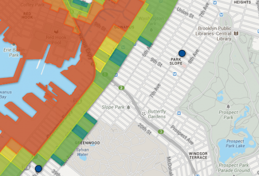
The new map is shown above, and you can enter your address and zoom in here; the older one, seen below, can be seen and zoomed in here. The new zones are labeled 1-6 (replacing A, B, and C), and are based on costal flood risks.
The main differences between the old and the new are that those extra zones allow for more variation on how an evacuation order might affect you. Where you may have been in Zone B before, you may now be in Zone 3, even though the next block over is now in Zone 4.
Hurricane season is currently underway — it lasts from June through November, and the 2013 season looks like it could be a rough one. Last month NOAA predicted an above-average season in the Atlantic, citing “a strong West African monsoon, warmer-than-average water temperatures in the tropical Atlantic and Caribbean Sea, and the lack of an El Nino” as contributing factors, according to NPR.
Check to see what your new zone is online or by calling 311, and see the city’s suggestions on how to prepare yourself and your family for a potential hurricane.


