
New Hurricane Evacuation Map Affects More Of Ditmas Park


The city has unveiled its new hurricane evacuation map, and the new zones spread a little further into our area than they did in the previous version. Gothamist notes that the new map adds “an additional 600,000 New Yorkers not included within the boundaries of the former zones.”
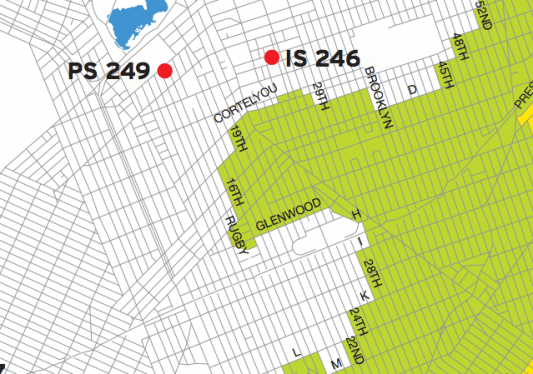
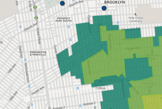
The new map is shown above at the top, and you can enter your address and zoom in here; the older one, seen just above, can be seen and zoomed in here. The new zones are labeled 1-6 (replacing A, B, and C), and are based on coastal flood risks. Parts of our area that were previously Zone C — which the city said could be affected by storm surges from Category 3 and 4 hurricanes — are now in Zone 5 and 6.
But the new Zone 6 now stretches a bit further than Zone C did, hitting roads as far north as Beverley and Tilden, and as far west as Coney Island Avenue. In fact, it now encompasses PS 217 on the corner of Newkirk and CIA, which has, in the past, served as an additional evacuation center.
Hurricane season is currently underway — it lasts from June through November, and the 2013 season looks like it could be a rough one. Last month NOAA predicted an above-average season in the Atlantic, citing “a strong West African monsoon, warmer-than-average water temperatures in the tropical Atlantic and Caribbean Sea, and the lack of an El Nino” as contributing factors, according to NPR.
Check to see if you’re in one of the new zones online or by calling 311, and see the city’s suggestions on how to prepare yourself and your family for a potential hurricane.


